How Many Of These 15 Most Dangerous U.S. Road Trips Have You Driven
Some drives are pure postcard, and others demand your full attention every mile.
Narrow cliff roads, sudden weather shifts, wildlife crossings, and stretches with little help nearby can turn a “scenic route” into a serious test of nerves.
This list looks at fifteen U.S. road trips known for real hazards, the kind that earn respect and a steady grip on the wheel.
How many have you tackled so far?
Disclaimer: This article provides general, opinion-based commentary on well-known road trips and is not intended as travel, driving, or safety advice.
1. Dalton Highway (AK-11), Livengood to Deadhorse
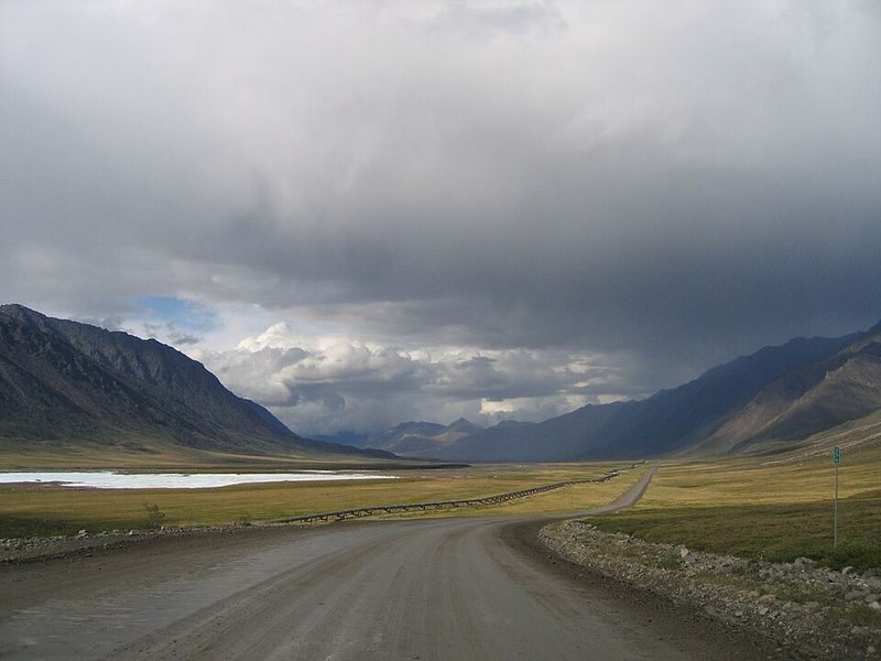
Stretching 414 miles through Alaska’s unforgiving wilderness, this gravel beast earned its reputation as one of North America’s most isolated routes.
Services are almost nonexistent for hundreds of miles.
Truckers haul massive loads while dodging potholes, ice patches, and wildlife.
Windshields crack from flying rocks, and cell service vanishes into the Arctic air.
Extreme cold can freeze fuel lines and drain batteries in minutes.
2. Denali Highway (AK-8), Paxson to Cantwell
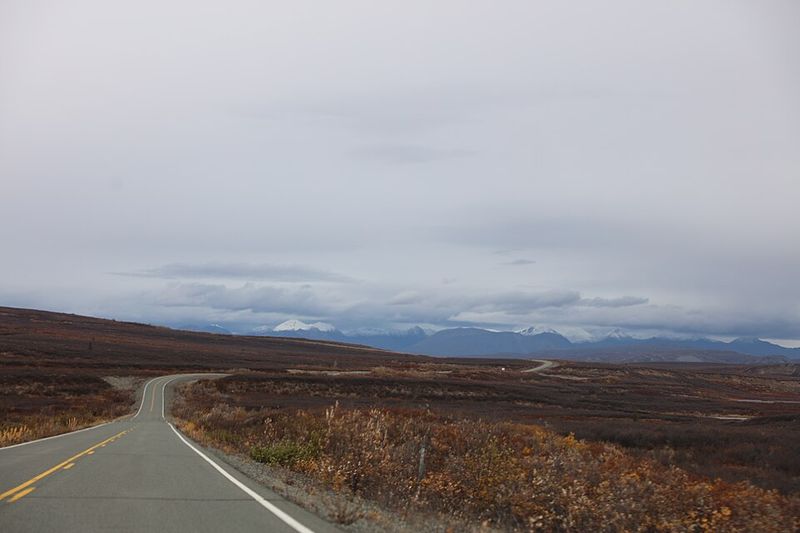
Mostly unpaved and wildly scenic, this 135-mile connector delivers raw Alaskan beauty alongside genuine danger.
Weather can shift from sunshine to whiteout conditions within an hour.
Few travelers venture here, meaning help is scarce if trouble strikes.
Gravel surfaces become slick mud during rain, testing traction and nerves alike.
Wildlife crossings are common, and sharp rocks puncture tires regularly.
3. Seward Highway (AK-1), Anchorage to Seward
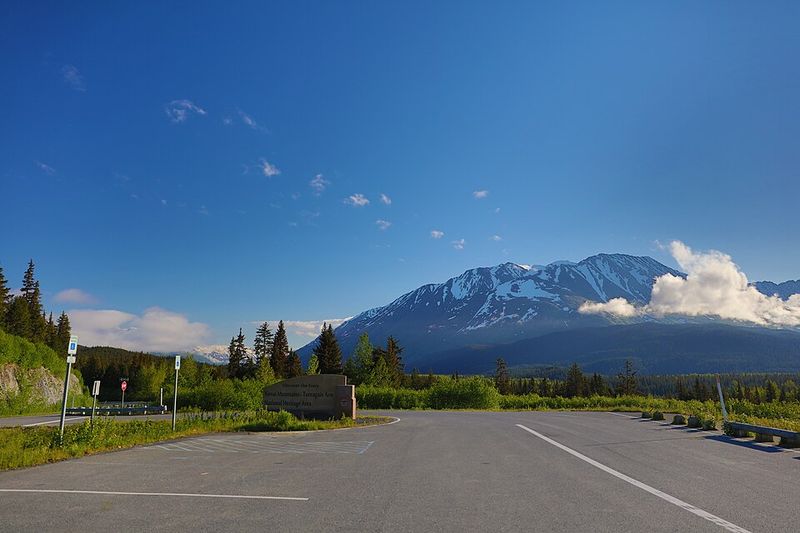
Hugging steep cliffs above Turnagain Arm, this stunning coastal route combines breathtaking views with white-knuckle driving.
Narrow lanes leave little room for error beside sheer drops.
Avalanches and rockslides close sections regularly during winter months.
Moose wander onto the pavement without warning, causing sudden collisions.
Fog rolls in fast, reducing visibility to nearly zero.
4. Going-to-the-Sun Road, Glacier National Park (MT)
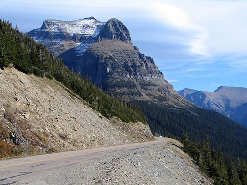
Carved into Glacier’s towering peaks, this engineering marvel terrifies as much as it amazes.
Hairpin turns and narrow passages challenge drivers while passenger-side wheels seem to hover over oblivion.
No guardrails protect many sections, and oncoming RVs squeeze past with inches to spare.
Snow keeps portions closed until July some years.
5. Beartooth Highway (US-212), Red Lodge (MT) to Yellowstone area (WY/MT)
Climbing to nearly 11,000 feet, this spectacular highway crosses some of America’s highest terrain.
Steep grades and tight switchbacks demand constant attention and smooth braking.
Afternoon thunderstorms appear suddenly at high altitude, bringing lightning and hail.
Snow can fall any month, turning pavement slick and treacherous instantly.
Altitude sickness affects some drivers, slowing reaction times.
6. Million Dollar Highway (US-550), Ouray to Silverton (CO)
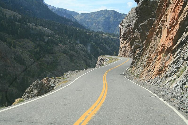
Named for either its construction cost or its ore-rich roadbed, this Colorado legend terrifies first-timers.
Sheer cliffs drop hundreds of feet without guardrails to catch mistakes.
Narrow lanes barely accommodate two vehicles passing simultaneously.
Winter ice and summer rockslides keep road crews busy year-round.
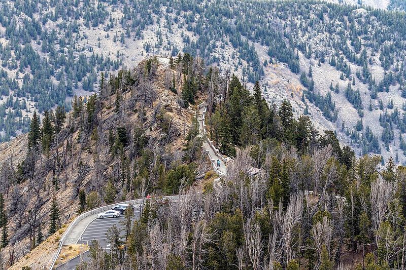
7. Trail Ridge Road, Rocky Mountain National Park (CO)
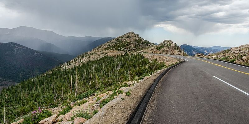
Topping out above 12,000 feet, this is America’s highest continuous paved road.
Oxygen levels drop noticeably, potentially affecting alertness and judgment behind the wheel.
Exposed to fierce winds and sudden storms, the road closes frequently during shoulder seasons.
Lightning strikes the open tundra with frightening regularity during summer afternoons.
8. I-70 Mountain Corridor, Georgetown to Vail Pass (CO)
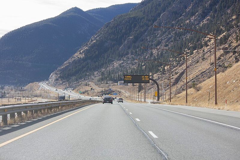
Heavy traffic meets steep mountain grades on this crucial cross-country artery.
Semis crawl uphill while ski-bound tourists rush past, creating dangerous speed differentials.
Winter blizzards shut down the highway regularly, stranding thousands.
Tunnels and avalanche zones add complexity to already challenging driving conditions.
Runaway truck ramps appear frequently for good reason.
9. Tail of the Dragon (US-129), Deals Gap (TN/NC)
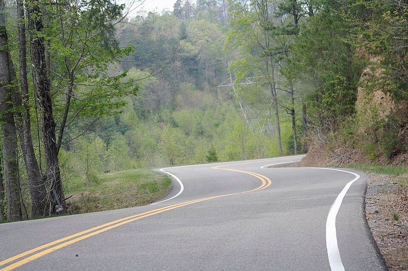
Packing 318 curves into just 11 miles, this legendary stretch attracts thrill-seeking motorcyclists and sports car enthusiasts.
Blind corners hide oncoming traffic, and riders sometimes cross center lines mid-turn.
Memorials along the roadside serve as sobering reminders of past tragedies.
10. Cherohala Skyway (TN-165/NC-143), Tellico Plains to Robbinsville
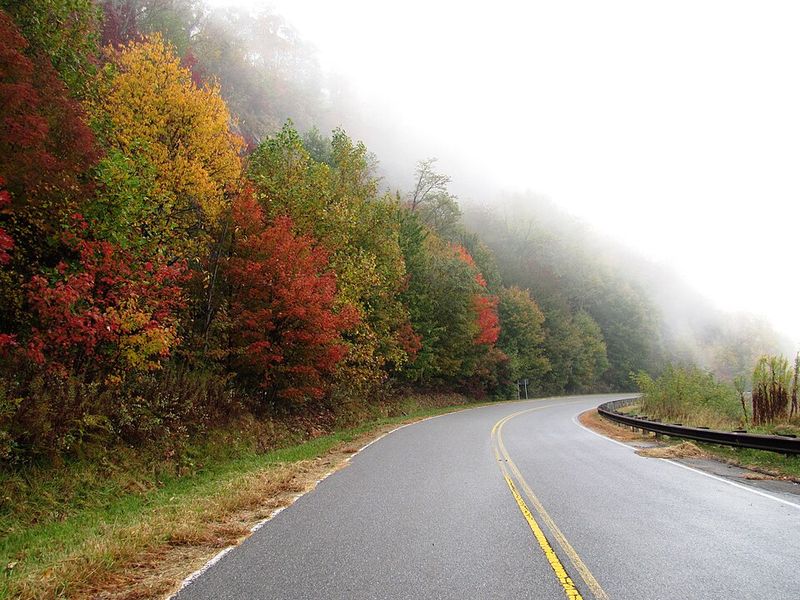
Climbing through remote Appalachian wilderness, this 43-mile skyway offers stunning vistas and serious elevation changes.
Fog descends quickly, reducing visibility to a few car lengths.
Motorcyclists flock here for sweeping curves that demand respect and skill.
Wildlife emerges from dense forests without warning, especially at dawn and dusk.
11. Blue Ridge Parkway, higher-elevation stretches (VA/NC)
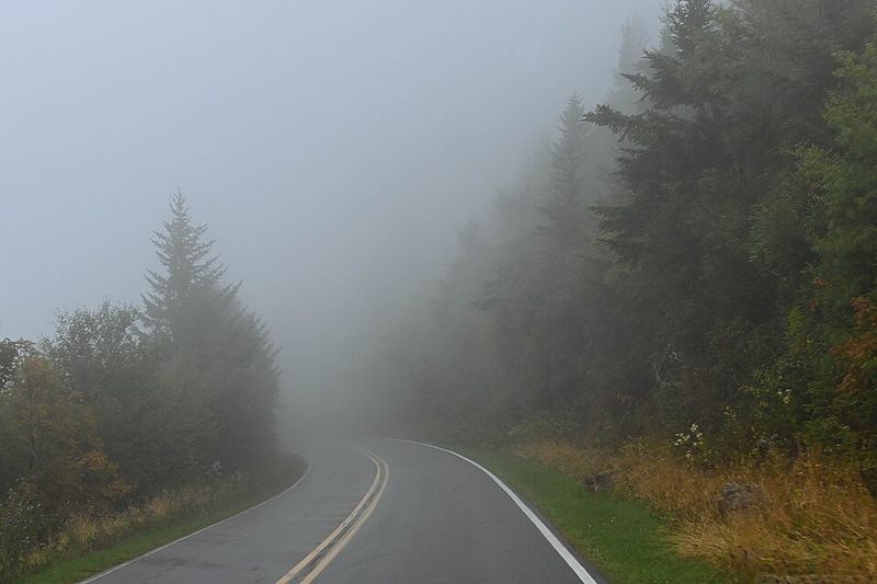
Winding 469 miles through Appalachian highlands, the parkway’s upper sections challenge drivers with elevation, weather, and tight curves.
Speed limits stay low, but impatient drivers still pass dangerously.
Fog banks appear suddenly, especially near mountaintops.
Ice lingers in shaded areas long after valleys thaw, surprising unprepared motorists.
12. Tioga Pass (CA-120), Yosemite high country (CA)
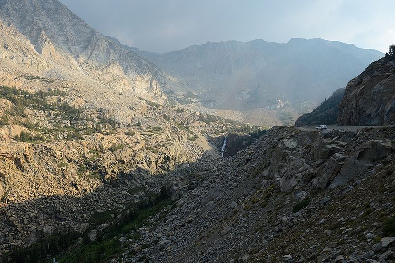
Crossing the Sierra Nevada at 9,945 feet, Tioga Pass opens Yosemite’s high country to adventurous travelers.
Steep grades test brakes on long descents into the park.
Snow closes the pass from November through May or June most years.
Even summer brings afternoon thunderstorms that drench pavement and reduce traction.
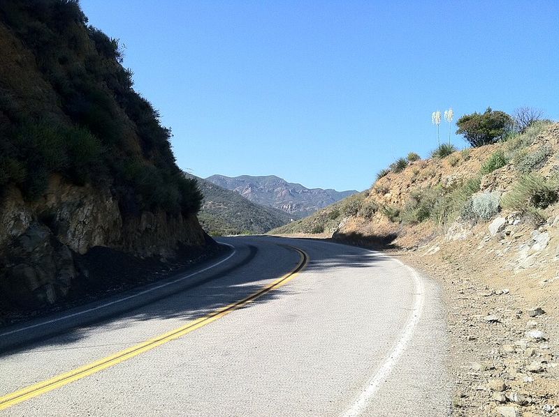
13. Angeles Crest Highway (CA-2), San Gabriel Mountains (CA)
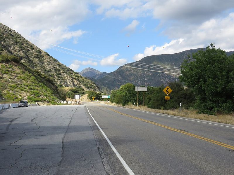
Rising from Los Angeles suburbs into rugged mountain terrain, this highway delivers quick access to wilderness and danger.
Sharp curves and steep dropoffs catch inexperienced drivers off guard.
Rockslides and washouts close sections regularly after storms.
Speed-seeking motorcyclists and street racers push limits.
14. Mulholland Highway “The Snake,” Santa Monica Mountains (CA)
Famous among motorcyclists and car enthusiasts, this twisting section of Mulholland attracts speed demons testing their skills.
Tight S-curves arrive in rapid succession, demanding precise control.
Photographers gather at popular corners, creating distractions and sometimes stepping into traffic.
Gravel and oil spills make surfaces slippery and unpredictable.
15. Overseas Highway (US-1), Miami area to Key West (FL)

Hopping between Florida Keys on 42 bridges, this ocean highway seems deceptively easy until conditions turn harsh.
Hurricanes and tropical storms transform the route into a dangerous wind tunnel.
Limited evacuation routes mean gridlock when storms approach.
High winds push vehicles sideways, especially on long exposed bridges like Seven Mile Bridge.