The Arizona Wonderland Where Rocks Seem To Touch The Sky
Hidden in the southeastern corner of Arizona lies a landscape that seems straight out of a fantasy world.
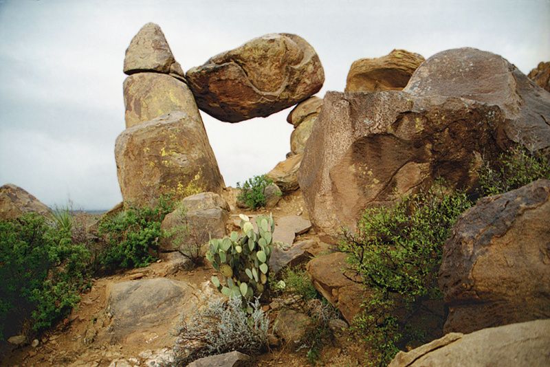
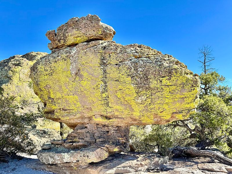
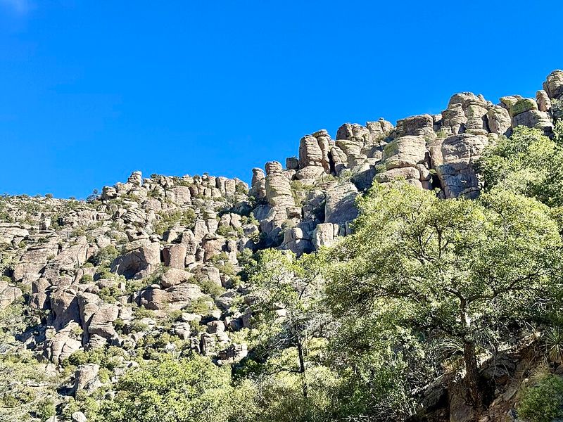
Chiricahua National Monument showcases towering rock spires, balanced boulders, and stone columns that have been carved by millions of years of volcanic activity and erosion.
This incredible place, once home to the Apache people and now a protected treasure, offers visitors a chance to explore one of nature’s most spectacular rock gardens.
Ancient Volcanic Origins That Shaped The Landscape
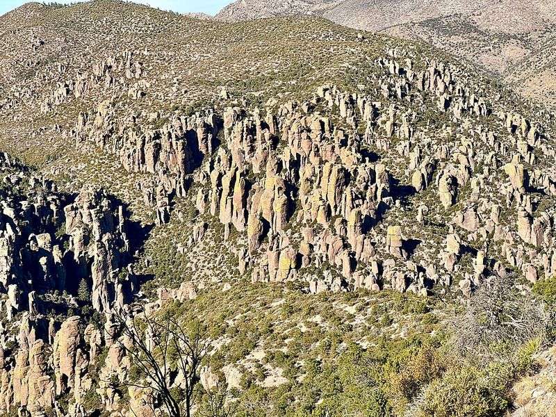
About 27 million years ago, a massive volcanic eruption shook this region with unimaginable force.
The Turkey Creek Volcano spewed out nearly 2,000 times more material than Mount St. Helens did in 1980.
Hot ash and rock fragments welded together, creating a thick layer called rhyolite tuff.
Over millions of years, wind, rain, and ice slowly carved this volcanic rock into the bizarre pillars and balanced rocks we see today, transforming destruction into breathtaking beauty.
Heart Of Rocks Loop Trail Adventure
Want to walk through a maze of stone giants? The Heart of Rocks Loop delivers exactly that experience with jaw-dropping scenery at every turn.
This 7.5-mile trail winds through the monument’s most spectacular formations, including Big Balanced Rock and Punch and Judy.
Names like Thor’s Hammer and Totem Pole describe rocks that truly seem alive. Pack plenty of water and snacks because you’ll want to linger and soak in every magical moment.
Unique Wildlife And Sky Island Ecosystem
Chiricahua sits at the meeting point of several major ecosystems, creating what scientists call a sky island.
This unique position means an incredible variety of plants and animals thrive here.
Visitors might spot coatis, black bears, or elegant white-tailed deer roaming among the rocks.
Over 170 bird species have been recorded, making it a paradise for birdwatchers.
The elevation changes create distinct climate zones, supporting everything from desert cacti to mountain pines.
Bonita Canyon Drive Scenic Route
Not everyone wants to hike miles to see amazing views, and that’s perfectly fine here.
Bonita Canyon Drive offers an eight-mile paved road that climbs from the visitor center to Massai Point.
Along the way, pullouts provide stunning photo opportunities and interpretive signs explain the geology and history.
The road gains 1,000 feet in elevation, showcasing how the landscape transforms.
At the top, Massai Point rewards travelers with panoramic views that stretch across three states.
Faraway Ranch Historic Site
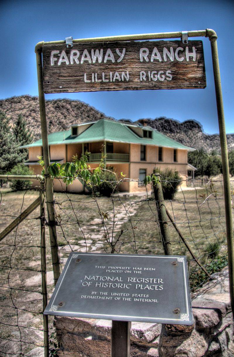
Step back in time at Faraway Ranch, where Swedish immigrants Neil and Emma Erickson built their homestead in 1888.
Their daughter Lillian grew up exploring these rock formations and eventually turned the ranch into a guest destination.
Lillian’s passionate efforts helped establish Chiricahua as a national monument in 1924.
Today, visitors can tour the preserved ranch buildings and learn how frontier families lived while marveling at the determination it took to thrive in such remote wilderness.